 Hocking Hills
Where all the best roads lead . . .HIKE. STAY. PLAY. YOUR HOCKING HILLS ADVENTURE BEGINS HERE!
Buy our Guidebooks Each offers different trails to explorE!
Hocking Hills
Where all the best roads lead . . .HIKE. STAY. PLAY. YOUR HOCKING HILLS ADVENTURE BEGINS HERE!
Buy our Guidebooks Each offers different trails to explorE!

- Home
- Hiking
- Ash Cave
- Cedar Falls
- Old Man's Cave
- Whispering Cave
- Conkle's Hollow
- Cantwell Cliffs
- Rock House
- Hidden Waterfalls
- Rose Lake at Old Man's Cave
- Ash Cave to Cedar Falls
- Balanced Rock/Devil's Tea Table
- Airplane Rock
- Peninsula Trail_Lake Hope State Park
- Hope Furnace Trail-Lake Hope State Park
- Vinton County Parks: Moonville Rail Trail
- Clear Creek Metro Park - Fern Creek Trail
- Clear Creek Metro Park - Cemetery Ridge Hemlock Loop
- Boch Hollow Nature Preserve
- Zaleski Backpack Trail
- Mountain Bike Trails - Old Man's Cave
- Mountain Bike Trails - Lake Hope
- Fall Colors Hiking
- Dog Friendly Trails
- Bigfoot Trails
- Hike the Fringe: Closeby Trails
- Cabins/Lodging
- Camping
- Programs/Events
- Find Your Adventure. Try New Things!
- General Park Information
- Travel Itineraries
Rock House Hiking Trail
Official Rock House hiking guide from TheHockingHills.org.
Rock House, 16350 State Route 374, Laurelville, OH 43135 | GPS: (39.496345, -82.614583)
Hiked and field-checked for The Hocking Hills Organization by Jannette Quackenbush
Last checked: July 2026
Route checked: Rock House Upper Rim Trail and Lower Gorge Trail
GPS-recorded distances: Upper Rim Trail, 0.6 mile; Lower Gorge Trail, 0.2 mile
GPS device: Garmin GPSMAP 64sx
Difficulty: The Upper Rim Trail is difficult, with rugged ascents and descents and dangerous cliff edges. The Lower Gorge Trail is moderate, with a rugged dirt path and repeated ascents and descents.
Rock House is one of the seven major hiking areas in Hocking Hills State Park.
Hikers enter from either the upper or lower parking lot, but both trails come together and exit at the shelter house (at the top).
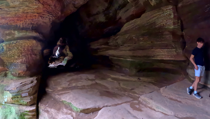
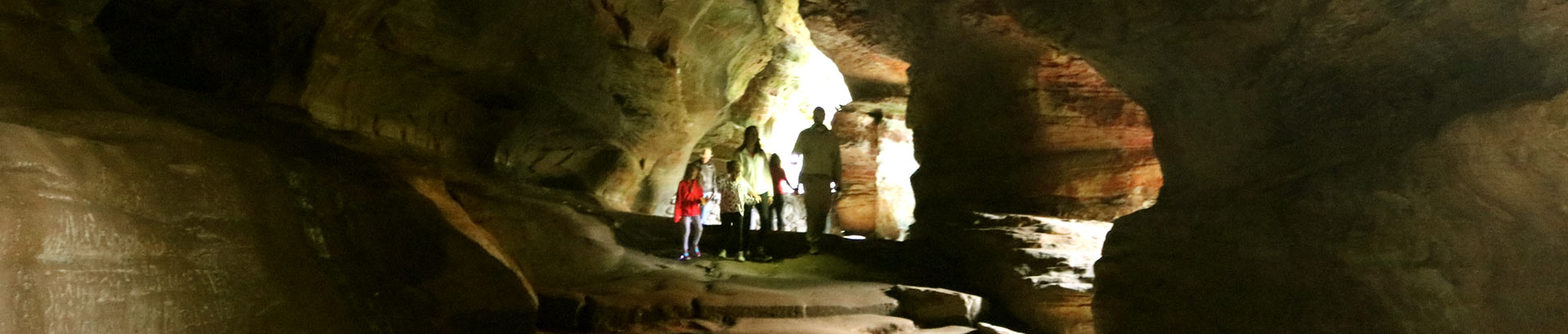
Rock House is commonly called a cave, but it is more accurately described as a recess cave. Unlike a true cave, which extends beyond the zone of natural light, Rock House formed in sandstone and has large openings that allow daylight to enter.
HIKERS MUST REMAIN ON THE MARKED TRAIL.
Well-behaved, non-aggressive pets are permitted on leash.
There is NO wading or swimming allowed in the waterfalls or creeks.
Rock House Trails at a Glance
Upper Rim distance: 0.6 mile
Lower Gorge distance: 0.2 mile
Upper Rim difficulty: Difficult
Lower Gorge difficulty: Moderate
Trail type: One-way trail system with separate rim and gorge routes
Upper Rim terrain: Rugged ascents and descents with dangerous cliff edges
Lower Gorge terrain: Rugged dirt path with repeated ascents and descents
Wheelchair and stroller access: Not accessible
Pets: Permitted on leash
Parking: Upper and lower Rock House parking areas along State Route 374
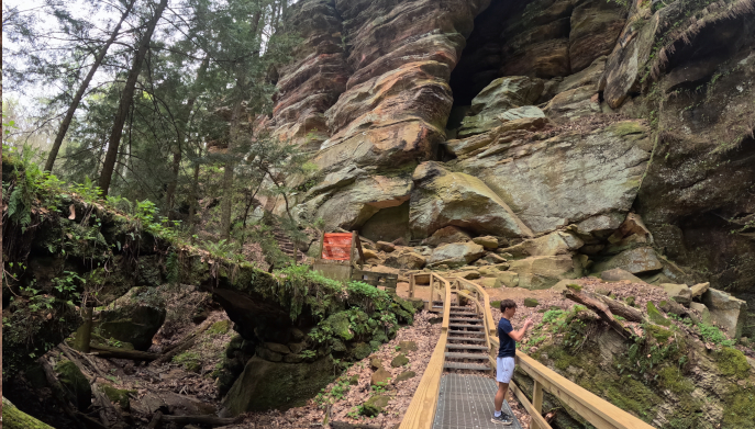
Main features: Rock House recess cave, cliff openings, stone steps, gorge views, and forested rim trail
GPS: 39.496345, -82.614583
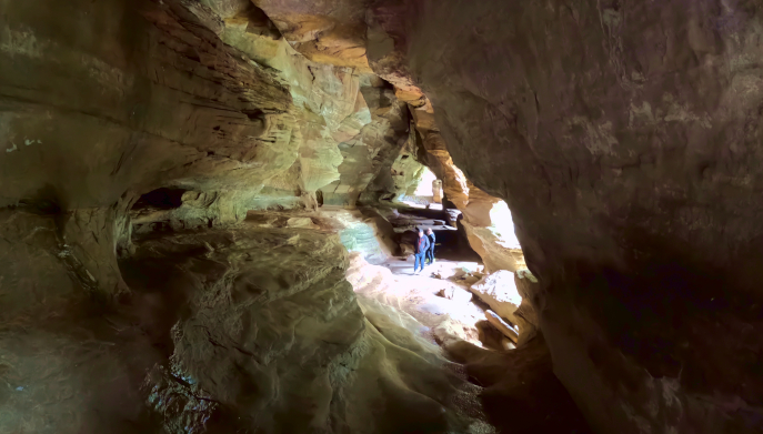
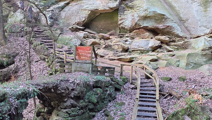
The trail to Rock House has steps, a strenuous grade, and beautiful views year-round.
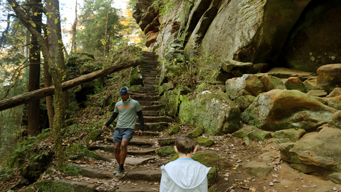
It is a one-way trail system.
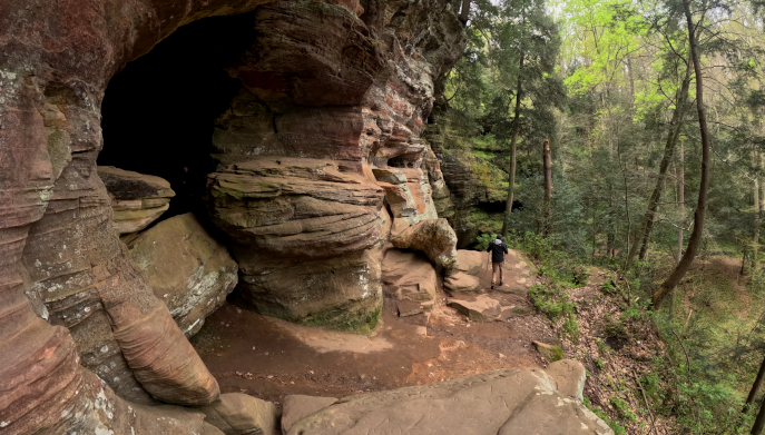
Hikers enter from either the upper or lower parking lot, but both trails come together and exit at the shelter house (at the top).
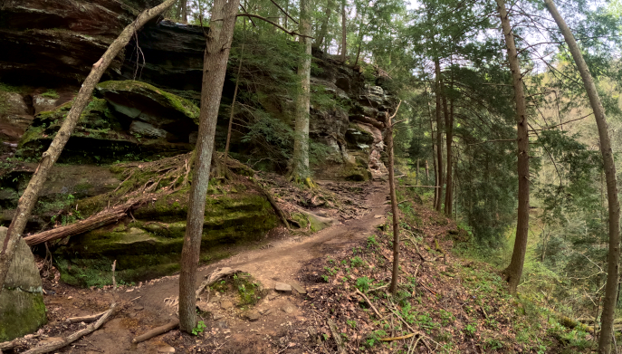
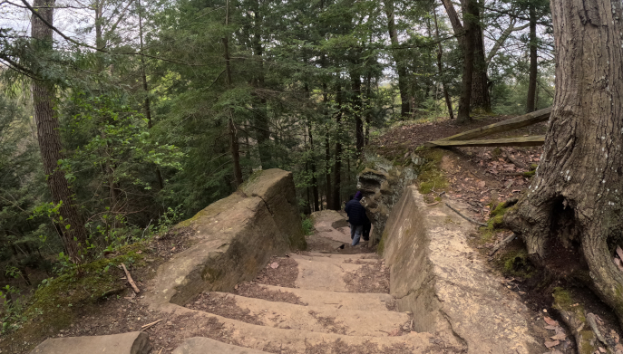
Hocking Hills State Park Trails - Rock House
Rock House
16350 OH-374 Laurelville, OH 43135
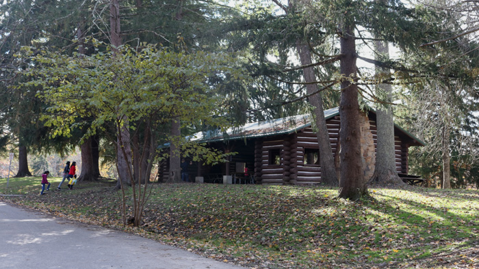
The Rock House Hotel once stood near this shelter located at Rock House. Remnants of its past can be seen around the property.
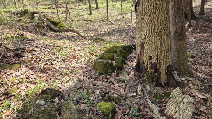
Take a hike to Rock House!
Hocking Hills Park Trail Areas
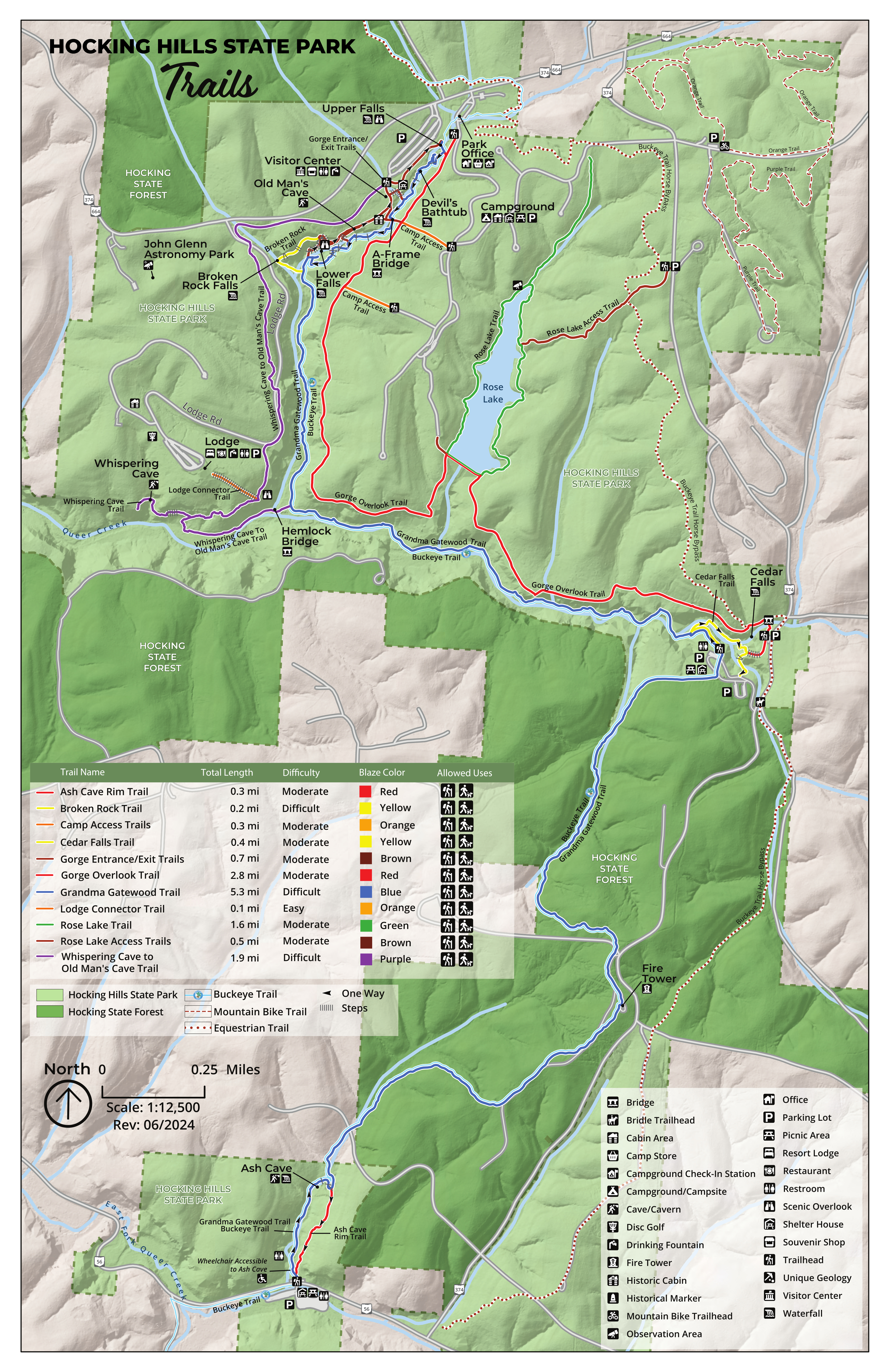
7 different hiking areas of Hocking Hills State Park- Ash Cave, Old Man's Cave, Rock House, Conkle's Hollow, Cedar Falls, Cantwell Cliffs, and Whispering Cave.
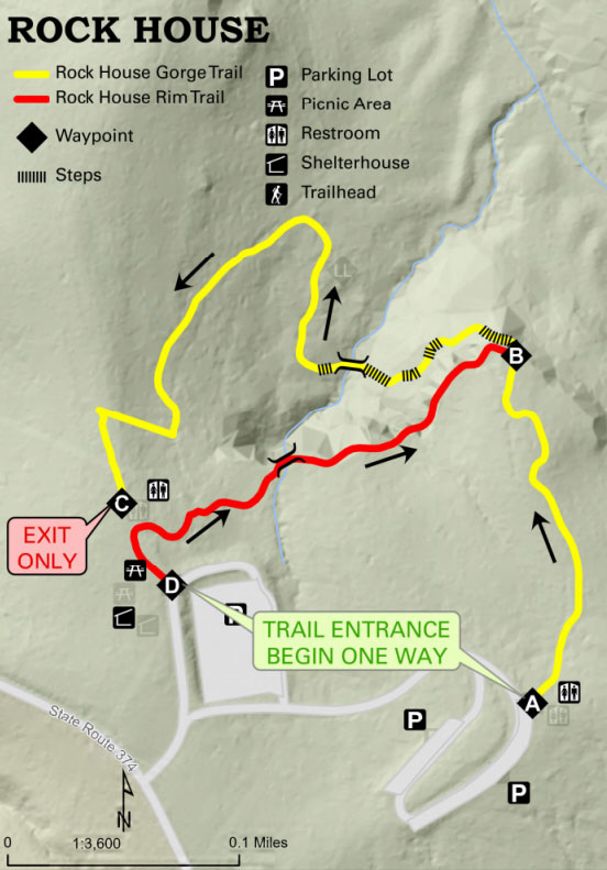
Rock House Trail Map
Start at Parking Area. End at Parking Area.
Yellow: Bottom of Gorge (Yellow Blazes on Trees)
Red: Top of Gorge Rim Trail (Red Blazes on Trees)
Take the complete route with you. The Hocking Hills Hiking Trail Guidebook includes field-checked directions, GPS coordinates, trail junctions, elevation information, parking details, and route combinations for Rock House and many additional Hocking Hills trails.
Common Questions About Rock House
How long are the Rock House trails?
The GPS-recorded Upper Rim Trail is approximately 0.6 mile. The Lower Gorge Trail is approximately 0.2 mile.
Is Rock House difficult to hike?
Yes. The Upper Rim Trail is difficult, with rugged ascents and descents and dangerous cliff edges. The Lower Gorge Trail is moderate, with a rugged dirt path and repeated ascents and descents.
Is Rock House a one-way trail?
Yes. Rock House follows a one-way trail system with separate upper rim and lower gorge routes.
Is Rock House a real cave?
Rock House is more accurately described as a recess cave. It formed in sandstone and has large openings that allow light to enter.
Are there many steps at Rock House?
Yes. The trails include numerous stone steps, steep grades, uneven surfaces, and rugged climbs and descents.
Are there dangerous cliff edges at Rock House?
Yes. The Upper Rim Trail includes dangerous cliff edges. Hikers must remain on the marked trail and use extra caution near overlooks and drop-offs.
Is Rock House suitable for young children?
The Upper Rim Trail may not be suitable for young children, inexperienced hikers, people with mobility or health concerns, or anyone uncomfortable with steep terrain and exposed cliff edges.
Are dogs allowed at Rock House?
Yes. Well-behaved, non-aggressive pets are permitted on leash, but the steps, rugged terrain, and cliff edges may make the trail difficult for some dogs.
Is Rock House wheelchair or stroller accessible?
No. The trails include steep grades, uneven ground, stone steps, roots, and rugged surfaces.
Can visitors swim or wade at Rock House?
No. Wading and swimming are not permitted in the waterfalls, creeks, or other park waterways.
Where should visitors park for Rock House?
Parking is available at the upper and lower Rock House parking areas along State Route 374 near Laurelville, Ohio.
What are the main features at Rock House?
The trails include the Rock House recess cave, cliff openings, stone steps, gorge views, forested slopes, and the upper rim trail.
Rock House - Hocking Hills State Park
Rugged trails lead to a sandstone recess cave with gothic-like openings and views across the gorge.
Part of the 7 trail systems within Ohio's Hocking Hills State Park
A remarkable sandstone recess cave with window-like openings.
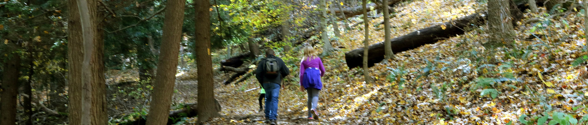
OPEN ALL YEAR-ROUND FROM DAWN TO DUSK
There are seven major hiking areas in Hocking Hills State Park - All are one-way trail systems.
Click here for a Regional Hocking Hills Trail Area Map
Ash Cave, Old Man's Cave, Rock House, Conkle's Hollow, Cedar Falls, Cantwell Cliffs, and Whispering Cave Trail. These park areas offer a unique experience for those who walk its paths no matter what season (the park is open year-round from dawn to dusk)—located on the southern edge of Hocking County. But those are just a handful. Other hiking trails in the Hocking Hills region include those at Wayne National Forest, Clear Creek Metro Parks, Lake Hope State Park, the Moonville Rail Trail, and the Hockhocking Adena Bikeway.