 Hocking Hills
Where all the best roads lead . . .HIKE. STAY. PLAY. YOUR HOCKING HILLS ADVENTURE BEGINS HERE!
Buy our Guidebooks Each offers different trails to explorE!
Hocking Hills
Where all the best roads lead . . .HIKE. STAY. PLAY. YOUR HOCKING HILLS ADVENTURE BEGINS HERE!
Buy our Guidebooks Each offers different trails to explorE!

- Home
- Hiking
- Ash Cave
- Cedar Falls
- Old Man's Cave
- Whispering Cave
- Conkle's Hollow
- Cantwell Cliffs
- Rock House
- Hidden Waterfalls
- Rose Lake at Old Man's Cave
- Ash Cave to Cedar Falls
- Balanced Rock/Devil's Tea Table
- Airplane Rock
- Peninsula Trail_Lake Hope State Park
- Hope Furnace Trail-Lake Hope State Park
- Vinton County Parks: Moonville Rail Trail
- Clear Creek Metro Park - Fern Creek Trail
- Clear Creek Metro Park - Cemetery Ridge Hemlock Loop
- Boch Hollow Nature Preserve
- Zaleski Backpack Trail
- Mountain Bike Trails - Old Man's Cave
- Mountain Bike Trails - Lake Hope
- Fall Colors Hiking
- Dog Friendly Trails
- Bigfoot Trails
- Hike the Fringe: Closeby Trails
- Cabins/Lodging
- Camping
- Programs/Events
- Find Your Adventure. Try New Things!
- General Park Information
- Travel Itineraries
Old Man’s Cave Hiking Trail
Official Old Man’s Cave hiking guide from TheHockingHills.org.
Old Man’s Cave, State Route 664, Logan, OH 43138 | GPS Tracking: (39.437176, -82.539667)
Hiked and field-checked for The Hocking Hills Organization by Jannette Quackenbush
Last checked: July 2026
Route checked: Upper Falls through the lower gorge, past Old Man’s Cave, and back to the Visitor Center and parking area
GPS-recorded loop: 1.0 mile from Upper Falls to the Old Man’s Cave exit
GPS device: Garmin GPSMAP 64sx
Difficulty: Moderate to difficult; steps descend into the gorge and climb back out
Trail notes: Stone steps near Upper Falls are rugged. The gorge trail is comparatively easy, followed by numerous steps leading up from Old Man’s Cave.
Old Man’s Cave is one of the seven major hiking areas in Ohio’s Hocking Hills region. The main one-way gorge trail begins near Upper Falls and descends by rugged stone steps into the gorge. From there, hikers pass Devil’s Bathtub, stone tunnels, cliffs, rock formations, and the recess cave known as Old Man’s Cave.
The shortest loop is approximately 1.0 mile. Hikers exit the gorge near Old Man’s Cave and climb a series of steps back toward the Visitor Center and parking area. Although much of the lower gorge trail is comparatively easy, the stone steps entering and leaving the gorge make the complete hike moderate to difficult.
Hikers may also continue beyond Old Man’s Cave toward Lower Falls and Broken Rock Falls and use a later exit back toward the Visitor Center. Longer trail connections continue toward Rose Lake, Cedar Falls, and Ash Cave. These extended routes require additional time and are more strenuous than the shortest loop.
The gorge trail is not wheelchair or stroller accessible. A separate accessible trail begins near the Park and Camp Office and passes the Visitor Center before reaching the Upper Falls observation area.
Hikers must remain on marked trails. Well-behaved, non-aggressive pets are permitted on leash, although the gorge trail may not be suitable for some pets because of the cliffs, narrow passages, rugged steps, and crowds. There is no wading or swimming allowed in the waterfalls or creeks.
Old Man’s Cave Trail at a Glance
Shortest loop: 1.0 mile from Upper Falls to the Old Man’s Cave exit
Typical hiking time: About 60 minutes for the shortest loop
Difficulty: Moderate to difficult
Trail type: One-way gorge trail with multiple exit options
Wheelchair and stroller access: Separate accessible trail near the Visitor Center and Upper Falls observation area. No access for wheelchairs in the gorge.
Pets: Permitted on leash, but not recommended because of cliffs, narrow paths, and steps
Restrooms: Available near the Visitor Center and parking area
Main features: Upper Falls, Devil’s Bathtub, Old Man’s Cave, stone tunnels, cliffs, and Lower Falls
Trail connections: Longer routes continue toward Lower Falls, Broken Rock Falls, Rose Lake, Cedar Falls, and Ash Cave
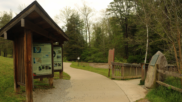
The trail is one-way with an entrance at the kiosk by the parking lot at Upper Falls. Old Man's Cave is busiest in the later morning and afternoon. Weekdays are much less crowded. Hikers must stay on designated trails!
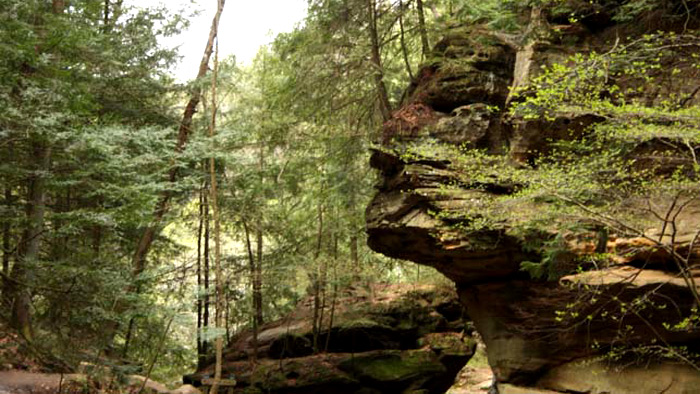
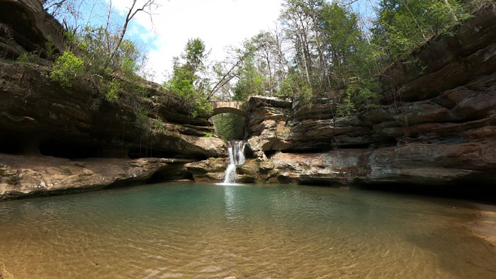
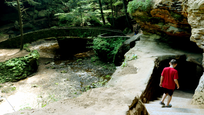
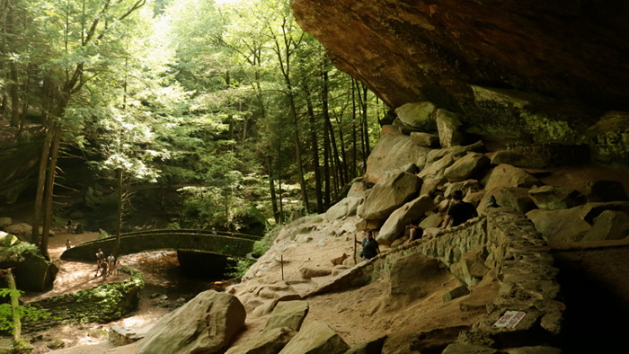
Hikers can view recess caves along the trail, including the well-known Old Man’s Cave, waterfalls like Lower Falls and Devil’s Bathtub, cliffs, stone tunnels, and unique rock formations like Sphinx Head.
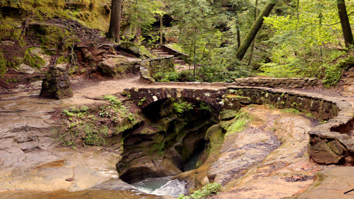
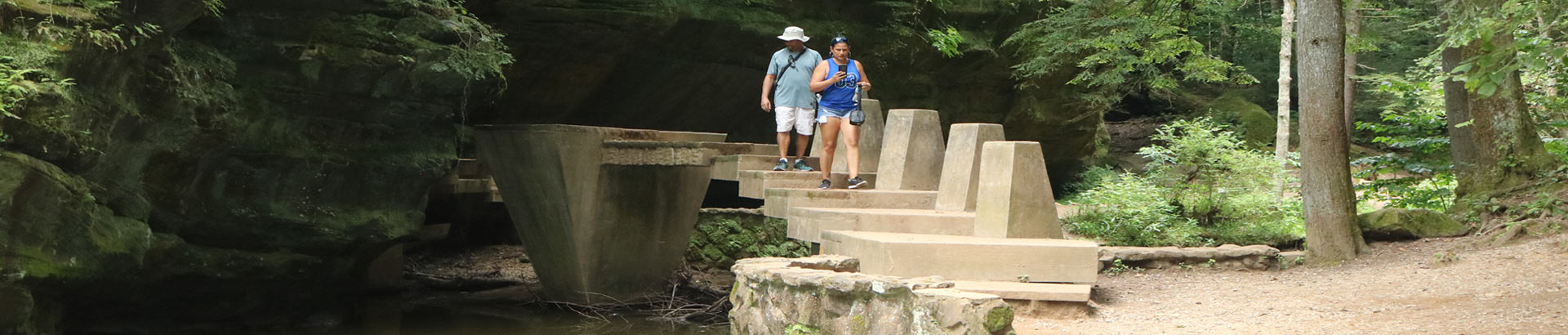
Hikers traverse a rock bridge over Devil's Bathtub, a unique formation along the trail. There are also stone tunnels to walk through. There are also narrow paths along cliffs, so those with a fear of heights or balance issues may want to try another trail.
Hocking Hills Park Trail Areas
7 different hiking areas of Hocking Hills State Park- Ash Cave, Old Man's Cave, Rock House, Conkle's Hollow, Cedar Falls, Cantwell Cliffs, and Whispering Cave.
Take a short hike through Old Man’s Cave with The Hocking Hills Organization, an official Hocking Hills visitor and hiking guide providing field-checked trail information, maps, travel guides, and local visitor information since 1997.
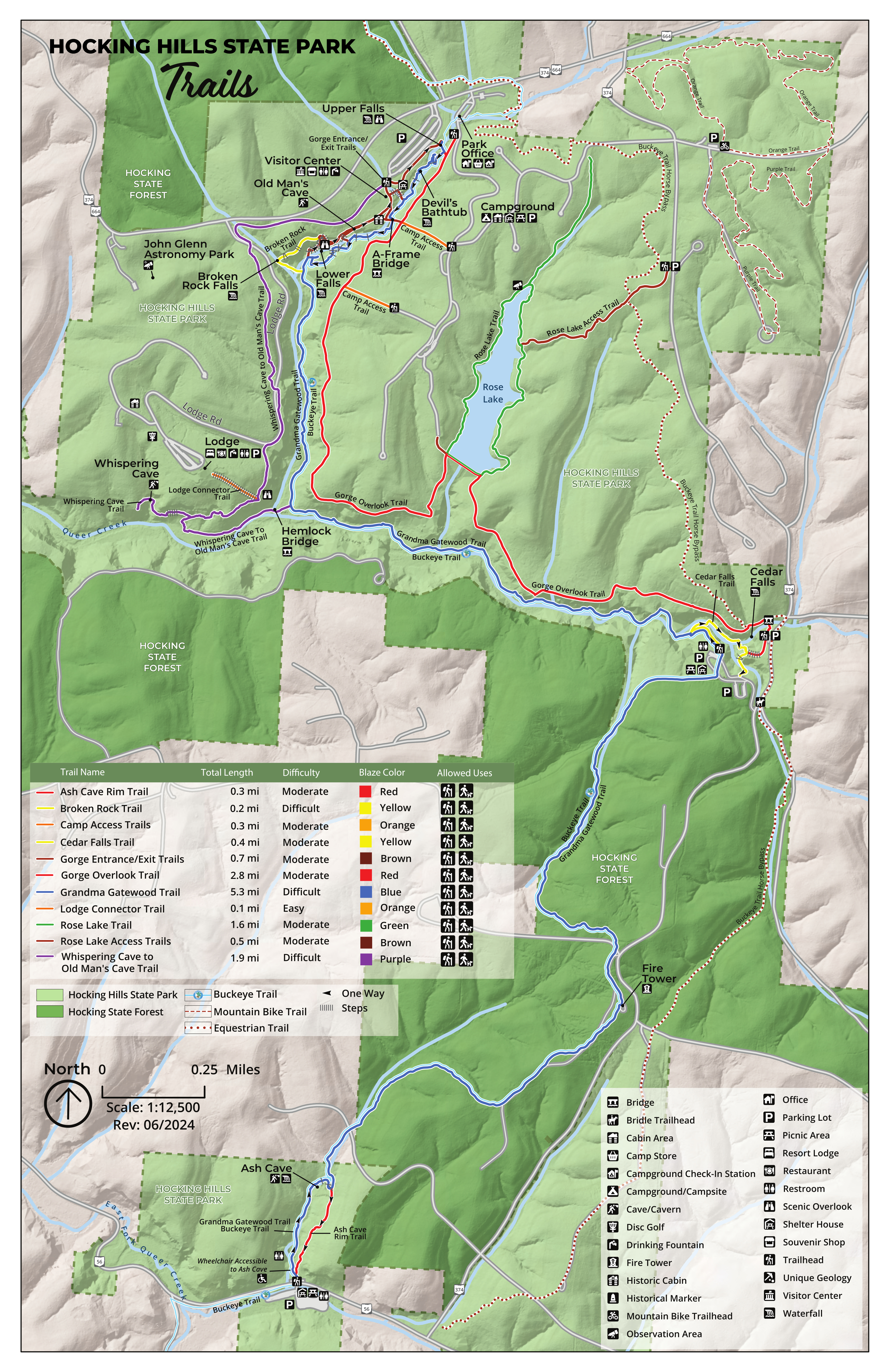
Old Man's Cave Trail Map
Start at Parking Area. End at Parking Area.
Blue: Bottom of Gorge (Blue Blazes on Trees)
Red: Top of the Gorge Rim Trail (Red Blazes on Trees)
Purple is the Whispering Cave Loop Trail
Take the complete route with you. The Hocking Hills Hiking Trail Guidebook includes field-checked directions, GPS coordinates, trail junctions, elevation information, parking details, exit options, and route combinations for Old Man’s Cave and many additional Hocking Hills trails.
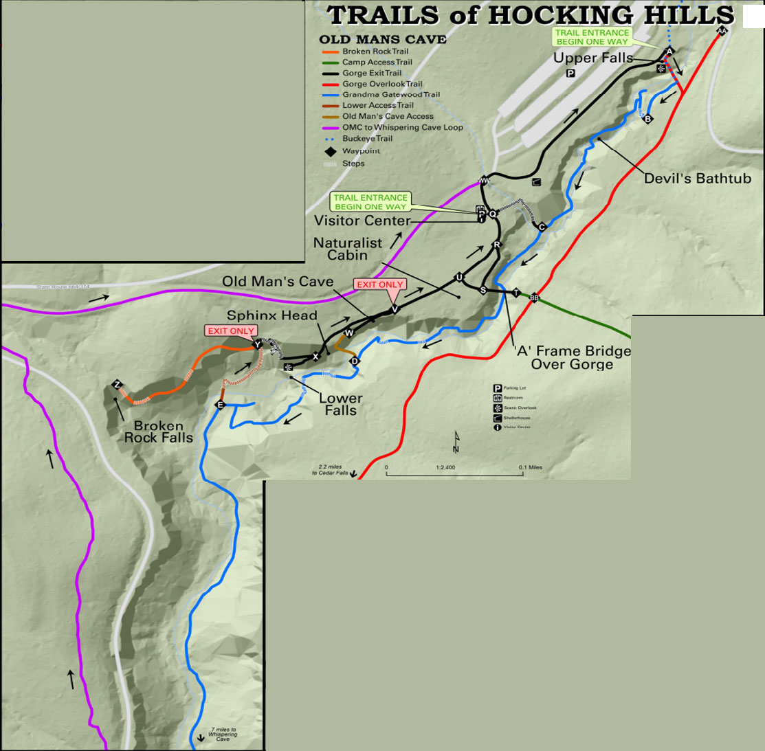
Hocking Hills State Park Trails - Old Man's Cave
Old Man's Cave - Hocking Hills State Park
OH-664 Logan, OH 43138
Common Questions About Old Man’s Cave
How long is the Old Man’s Cave hiking trail?
The shortest Old Man’s Cave loop is approximately 1.0 mile from Upper Falls to the Old Man’s Cave exit and generally takes about 60 minutes to hike.
Is Old Man’s Cave a difficult hike?
Old Man’s Cave is moderate to difficult. The gorge trail is comparatively easy, but hikers must use rugged stone steps to enter the gorge and climb numerous steps to return to the Visitor Center and parking area.
Where does the Old Man’s Cave trail begin?
The main one-way trail begins near Upper Falls and follows the gorge past Devil’s Bathtub, rock formations, and Old Man’s Cave.
Can hikers continue past Old Man’s Cave to Lower Falls?
Yes. Hikers may continue through the gorge toward Lower Falls and use a later exit route back toward the Visitor Center. This longer route is more strenuous than exiting at Old Man’s Cave.
Is Old Man’s Cave wheelchair accessible?
The gorge trail is not wheelchair accessible. A separate accessible trail near the Visitor Center leads toward an observation area at Upper Falls.
Can hikers continue from Old Man’s Cave toward Cedar Falls?
Yes. Longer trails connect the Old Man’s Cave area with Rose Lake and Cedar Falls. Detailed junctions, distances, and route combinations are included in the Hocking Hills Hiking Trail Guidebook.
Old Man's Cave- Hocking Hills State Park
Upper Falls at Old Man's Cave is one of the starting points for the one-way loop trail.
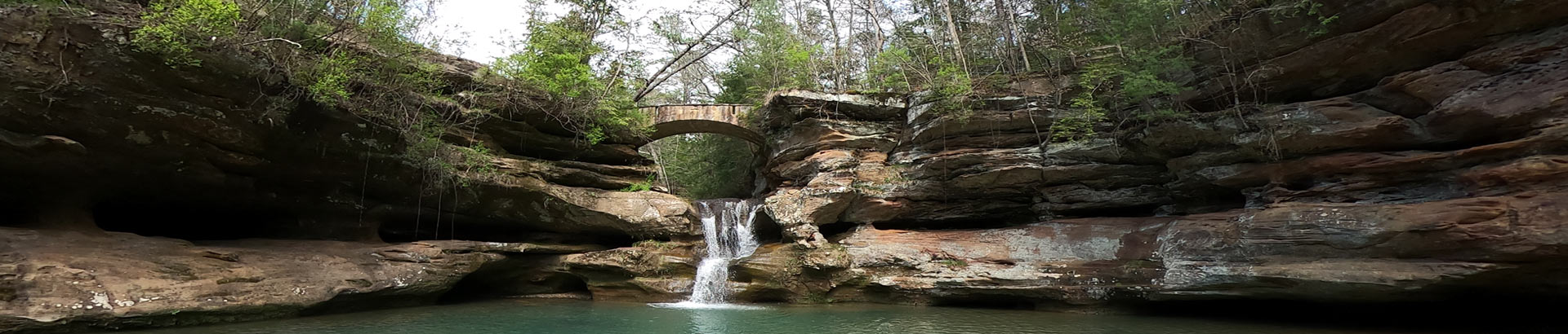
One of the Seven Major Hiking Areas in Ohio’s Hocking Hills
Old Man's Cave is the beginning point of Winter Hike. It is also along the Grandma Gatewood Trail.
OPEN ALL YEAR-ROUND FROM DAWN TO DUSK
There are seven major hiking areas in Hocking Hills State Park - All are one-way trail systems.
Click here for a Regional Hocking Hills Trail Area Map
Ash Cave, Old Man's Cave, Rock House, Conkle's Hollow, Cedar Falls, Cantwell Cliffs, and Whispering Cave Trail. These park areas offer a unique experience for those who walk its paths no matter what season (the park is open year-round from dawn to dusk)—located on the southern edge of Hocking County. But those are just a handful. Other hiking trails in the Hocking Hills region include those at Wayne National Forest, Clear Creek Metro Parks, Lake Hope State Park, the Moonville Rail Trail, and the Hockhocking Adena Bikeway.